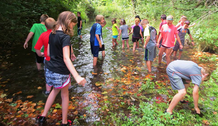
Do you know your watershed address? Everyone has a watershed address, because we all live in a watershed. What exactly is a watershed anyway?
At our offices in downtown Springfield, our watershed address looks like this: Jordan Creek to Wilson’s Creek to James River to Table Rock Lake to White River to Mississippi River to Gulf of Mexico.
The simplest definition of a watershed is “the region or area which drains into a river, stream or lake”. Every time it rains what doesn’t soak in or evaporate will eventually flow downhill to outflow points such as reservoirs (like Table Rock Lake), bays and oceans. For example, residents of Springfield live in either the Sac River or James River watersheds.
The James River watershed can be further narrowed down to sub-watersheds centered on a particular creek or stream. For example South Creek’s watershed boundary begins near Meador Park and the Battlefield Mall, with its headwaters beginning near National Avenue and Sunset Street.From there, South Creek flows in a westerly direction into Wilson’s Creek, which then flows south into the James River. The James then flows into Table Rock Lake, which was created when the White River, was dammed in the 1950s. The White River is a tributary of the Mississippi River, which flows into the Gulf of Mexico. Most people are surprised to learn that local water like South Creek has a direct connection to the Gulf.
The size of a watershed can vary – the Mississippi River watershed, for example, is the largest in the United States and drains 1.15 million square miles from all or parts of 31 U.S. states and two Canadian provinces, from the Rockies to the Appalachians. The size of a watershed is measured based on its geography and is known as a Hydrologic Unit Code, or “HUC.” The James River is classified as a HUC 8 watershed, or a medium-sized river basin, stretching almost 100 miles from its headwaters in Webster County to where it enters Table Rock Lake. Our watershed is also a part of the larger Mississippi River watershed.
As water travels throughout a watershed, it often picks up pollutants – while most people tend to think of point-source pollution, or pollutants that go directly into the stream from a permitted source or sometimes a spill, a majority of pollutants in our watershed today come from non-point source pollution. This non-point source pollution is just that, hard to pin point. It can come in the form of many things, from a leaky septic tank to stormwater runoff, which can include everything from oil and fluids on city streets to lawn care chemicals. Much of this runoff comes from impervious surfaces like parking lots, roads and other structures that creates a “fast lane” into our local waterways.
Algae blooms are largely the result of excess nutrients such as phosphorous or nitrogen, from urban lawn runoff, sediment erosion, agriculture or leaky sewer systems. The James River Basin Partnership was formed in 1997 in response to a 14-mile long algae bloom in the James River arm of Table Rock Lake, and since our formation, we have been involved in many grants and projects to protect our local water. These include the Lawn Steward Soil Testing Program and the Rain Barrel Rebate, both of which can assist in reducing the amount of nutrients (such as phosphorous and nitrogen) in area waters.
The Lawn Steward Program offers Springfield residents a free soil test, analysis and a 3-year suggested maintenance plan tailored to their lawn’s specific needs. While “manicured” lawns might make a good first impression, many times they are maintained with chemical fertilizers and pesticides, many of which can end up in downstream thanks to runoff. Healthy lawns and soil will allow plants to thrive, holding soil in place and allowing water to soak in, rather than creating excess stormwater runoff.
Our “Right as Rain” Rain Barrel Rebate program allows you to capture and store rainwater from your rooftop, thereby reducing runoff and conserving drinking water while using the captured water for non-potable uses like watering your lawn. In addition, rain barrel captures help minimize erosion in local streams and rivers. Residents of Greene and Christian County are eligible to receive the one-time rebate at a rate of 50 cents a gallon, based on your newly installed system’s capacity. For example, a 200-gallon system would yield a $100 one-time rebate.
In addition to these two programs, the partnership also offers volunteer opportunities to help with everything from stream clean-ups, to tree planting events, water quality monitoring efforts, and more. For example, since 2005JRBP members and volunteers have helped to remove over 83,250 pounds of trash and more than 700 tires from the James and Finley rivers!
In addition to our programs and projects, JRBP also works with other area governments and organizations. We’re excited about the City of Springfield’s Clean Pavement Initiative which encourages pavement sealant choices that are more protective of water quality. There are many sources of polycyclic aromatic hydrocarbons (PAHs) in the environment and they can be harmful to aquatic life in streams. Some studies have identified coal-tar-based pavement sealant as a major source. The program provides positive recognition with signage for homeowners and businesses who choose asphalt emulsion, which contains much lower concentrations of PAHs, when sealing their driveways and parking lots.
Every one of us lives in a watershed, so knowing our watershed address is vital to protecting our local waterways for future generations for a variety of uses, from drinking water to economic benefits such as tourism and our cultural heritage. If you would like to learn more about the James River Basin Partnership, please visit our web site, like us on Facebook, or follow us on Twitter or Instagram – or better yet, consider joining us as a member or volunteering at one of our many events. We’ll see you downstream!


