The City of Springfield was notified by the U.S. Department of Transportation June 26 that it was selected to receive a fiscal year 2024 Rebuilding American Infrastructure with Sustainability and Equity (RAISE) grant in the amount of $24.8 million for the “Ungap the Map” project, one of the Top 10 initiatives of the Forward SGF Comprehensive Plan.
The “Ungap the Map” project will construct approximately 3.14 miles of greenway trails connecting neighborhoods on the west side of Springfield. The project will eliminate at-grade crossings, install approximately four pedestrian bridges, remove abandoned culverts, install traffic calming and green infrastructure, construct ADA-accessible sidewalks and provide dedicated bicycle paths.
RAISE grants are awarded on a competitive basis for planning or constructing surface transportation infrastructure projects that advance the program goals of improving safety; equity; environmental sustainability; quality of life; workforce development and job quality; mobility and community connectivity; economic competitiveness and opportunity for wealth creation. Grants are awarded to projects that proactively address environmental justice in neighborhoods most impacted by decades of underinvestment, have been overburdened by pollution and located in areas of persistent poverty.
“City staff analyzed and prioritized critical gaps in the greenway system based on past community engagement and to target resources in historically impoverished neighborhoods. The project is intended to connect these severed trails and provide a fully connected trail system from westside neighborhoods to natural green space, regional parks, economic opportunities, downtown Springfield, and beyond,” said Mayor Ken McClure.
The RAISE grant will construct three vital trail connections and fulfill goals in the Parks and Recreation Master Plan (2021), the College Street Corridor Plan (2012), the West Central Neighborhood Plan (1998, currently being updated), Ozark Transportation Organization’s (OTO) Destination 2045 Plan and the OTO Trail Study (2017).
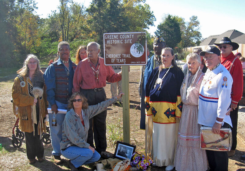
The connections and construction of the Jordan Creek, Wilson’s Creek and Trail of Tears greenways will fill trail gaps in some of Springfields most under-resourced neighborhoods, connect residents to Nathanael Greene and Rutledge-Wilson parks, the Grant Avenue Parkway, downtown Springfield, health care facilities, goods and services and the City Utilities Transit Center. The trails go beyond recreation – they provide a viable and equitable active transportation network for all residents of Springfield and the surrounding region.
“This project will provide transportation choices for the city’s most vulnerable populations to connect residents to employment centers, training and education, and enhancing opportunities for social interaction, strengthening the social fabric of our neighborhoods, which are important predictors of well-being,” said Director of Economic Vitality Amanda Ohlensehlen.
Forward SGF emphasizes that infrastructure and resources must be allocated to Springfield’s most under-resourced neighborhoods to elevate their standard of living to match other thriving areas. Poverty was one of the most cited issues during the Forward SGF community outreach process. Springfield’s northern and western neighborhoods were also identified during outreach and in the Forward SGF Issues and Opportunities Report to have the highest levels of disinvestment, aging infrastructure, poverty and unaffordable housing. The “Ungap the Map” project is intended to address the lack of transportation choices for the most vulnerable populations in Springfield while providing a safe and dedicated active transportation system.
The project will improve system-wide connectivity by providing 3.14 miles of dedicated trail that creates the critical mass of connected greenways in the city, amounting to more 25.2 miles of trail connectivity. The current longest continuous trail segment within the city is approximately six miles with the South Creek Trail that terminates at both ends and is utilized mostly for recreation.
These 3.14 miles are critical gaps that provide exponential connectivity to an area of the city that has been isolated by vehicle dominated transportation investments. These connections provide meaningful access to transit, provide micro-mobility, reduce reliance on single-occupancy vehicles, and expand transportation choices for residents. By providing a direct connection to the only mass transit station in the city the project will facilitate vital connections between different modes of transportation, making it easier for residents to access employment centers, educational institutions, health care facilities, and other essential destinations.
“This award builds on the City’s success with the Grant Avenue Parkway and demonstrates our ability to leverage grant dollars to attract reinvestment in key neighborhoods. The project continues to implement Forward SGF by closing the gaps in the trail network and connecting people to nature,” said City Manager Jason Gage.
Ohlensehlen added that matching funds for this grant are not required because all trail gaps and related infrastructure upgrades are primarily located in census tracts located within federally designated Areas of Persistent Poverty (APP) or Historically Disadvantaged Communities (HDC). U.S. Department of Transportation expects all RAISE funding to be obligated no later than Sept. 30, 2028 and expended by Sept. 30, 2033.


