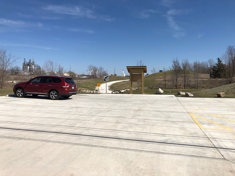
Construction for a half-mile Ozark Greenways trail connecting the area known as West Meadows, between Fort and Grant avenues north of the Birthplace of Route 66 Roadside Park, finished in fall 2020.
The $405,000 project was funded with a $250,000 Recreation Trails grant from the Missouri Department of Natural Resources (MDNR) with a 20% match provided through the 1/8-cent Transportation Sales Tax Alternative Transportation Program.
“The West Meadows connection was a key step in closing gaps along Jordan Creek Greenway,” said Ozark Greenways Executive Director Mary Kromrey. “This trail will ultimately stretch over 7 miles from Smith Park to Ewing Park, where it currently connects to Wilson’s Creek Greenway. This is a crucial link in connecting downtown, neighborhoods, several parks, and countless destinations! Additionally, the trails identified in Ozarks Transportation Organization’s regional trail investment study will tie this trail to the Route 66 Trail that will connect all the way to Strafford.”
The West Meadows trail is part of the vast Ozarks Greenways’ network of 73 miles of greenways, and 81 miles of on-street bike routes. A trailhead is located on the west end of the trail off of Fort Street and includes a parking lot. Access the trailhead by turning north on North Fort Avenue from West College Street north of the park.
About West Meadows
West Meadows is a brownfields redevelopment area located roughly between Main Avenue and Fort Avenue, just north of College Street (Historic Route 66) in downtown Springfield. The area is ripe with history. Historic Fulbright Spring, the location of one of Springfield’s earliest settlements, was discovered on the site during extensive environmental cleanup. The area was also the location of a Union soldier encampment during the Civil War, and lies adjacent to historic Route 66.
The development of West Meadows is part of the community’s Jordan Valley Concept Master Plan to redevelop the Jordan Valley through downtown Springfield. Work has been completed in Jordan Valley since the early 2000s, with $2 million in EPA-funded environmental brownfields clean-ups and the development of downtown amenities like Jordan Valley Park, Jordan Valley Commons, Jordan Valley Ice Park, Hammons Field and trail connections.
“What people know as Jordan Valley Park now is actually recognized as ‘East Meadows’ in the original concept plan,” explains City of Springfield Senior Planner and Brownfields Program Coordinator Olivia Hough. “West Meadows is an even larger block of open green space that carries the envisioned ‘central park’ concept through downtown.”
Previous improvements in West Meadows include the restoration of Jordan Creek to a natural wetland corridor, with stormwater, flood control and water quality improvements, native vegetation and trees. The area comprises 18 acres of open urban green space with trails planned for transportation and recreation.
“With currently no street access or parking available for West Meadows, this trail is the first step in opening this area up for public use,” says Hough.


